Satellite
Imagine gazing down at Earth from thousands of miles above, watching storms swirl, cities glow, and forests breathe—all in real time. It’s not science fiction; it’s the magic of live satellite imagery. Whether you’re a weather enthusiast tracking a hurricane or a curious soul wanting to see your hometown from space, near real-time satellite views offer an unprecedented perspective. In this article, we’ll explore what live satellite imagery is, how it works, and the best tools to access it. Buckle up for a journey above the clouds!
What Are Live Satellite Images?
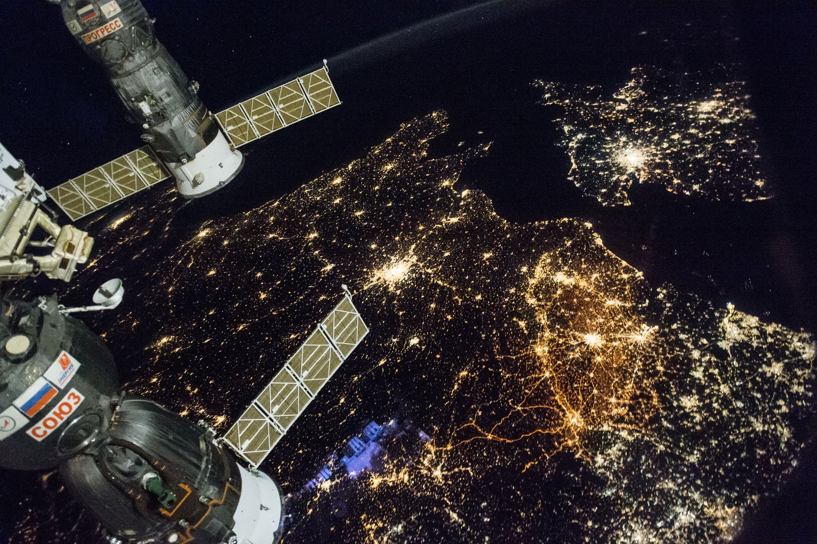
Live satellite images are high-resolution snapshots or video-like streams of Earth captured by satellites in orbit. These images, often updated every few minutes, provide a near real-time view of weather patterns, natural events, and human activity. Unlike static maps, they’re dynamic, showing the planet as it changes—think clouds moving or city lights flickering at night.
Why Are They Important?
These images aren’t just pretty pictures; they’re critical for monitoring weather, managing disasters, and even urban planning. For example, during Hurricane Katrina in 2005, satellite imagery helped first responders track the storm’s path in real time, saving countless lives. They’re a blend of science and storytelling, showing us Earth’s heartbeat.
How Do Live Satellite Images Work?
Satellites, like NOAA’s GOES or NASA’s Terra, orbit Earth and capture images using advanced sensors. Geostationary satellites, positioned 36,000 km above, provide continuous views of large regions, while polar-orbiting satellites offer detailed snapshots as they circle the globe. Data is transmitted to ground stations, processed, and uploaded to platforms for public access—often within minutes.
The Technology Behind It
The magic lies in optical and infrared sensors. Hemispherical sensors capture wide swaths of Earth, while narrow-field sensors zoom in on specific areas, like a ship crossing the Pacific. For instance, Live Earth Imaging’s constellation promises imagery updates every second, a game-changer for real-time monitoring.
Top Platforms for Live Satellite Imagery
Several platforms make it easy to access near real-time views of Earth. Each has unique strengths, catering to everyone from casual users to scientists. Let’s dive into the best options.
NOAA’s Earth in Real-Time
NOAA’s National Environmental Satellite, Data, and Information Service (NESDIS) offers an interactive U.S. Satellite Map. Updated continuously, it tracks storms, cloud cover, and weather patterns. It’s perfect for meteorologists or anyone curious about current conditions.
NASA Worldview
NASA’s Worldview app provides a satellite’s perspective with over 800 layers, including cloud cover and vegetation indices. Images, refreshed daily with a 60–125-minute delay, offer 250-meter resolution. It’s ideal for exploring global patterns, though fine details are limited.
Zoom Earth
Zoom Earth aggregates imagery from NOAA, EUMETSAT, and NASA, updating every 10–15 minutes. Its intuitive interface lets you track hurricanes or check local weather. The mobile app makes it accessible on the go, perfect for travelers.
USGS EarthNow!
The USGS EarthNow! Viewer uses Landsat 5 and 7 data to show near real-time imagery over the U.S. It’s like a live stream of Earth, with true-color or vegetation analysis views. It’s great for environmentalists studying land changes.
EUMETSAT Earth View
EUMETSAT’s streams, updated every 10 minutes, show true-color imagery by day and infrared at night. Covering the Atlantic and Indian Oceans, it’s a go-to for oceanic weather tracking. You can even embed their YouTube streams on your site.
Comparison of Top Platforms
| Platform | Update Frequency | Resolution | Key Features | Best For |
|---|---|---|---|---|
| NOAA NESDIS | Continuous | Varies | Storm tracking, cloud cover | Meteorologists, weather enthusiasts |
| NASA Worldview | Daily (60–125 min) | 250m/pixel | 800+ layers, global view | Researchers, educators |
| Zoom Earth | Every 10–15 min | High (varies) | Hurricane tracking, mobile app | Travelers, casual users |
| USGS EarthNow! | Near real-time | Moderate | True-color, vegetation analysis | Environmentalists |
| EUMETSAT Earth View | Every 10 min | High (varies) | True-color, infrared, embeddable streams | Oceanic monitoring, web developers |
Pros and Cons of Live Satellite Platforms
Pros:
- Accessibility: Most platforms are free and user-friendly.
- Real-Time Insights: Track weather, disasters, or environmental changes instantly.
- Versatility: Useful for education, research, and personal curiosity.
Cons:
- Resolution Limits: Free platforms often lack ultra-high resolution (e.g., 250m/pixel).
- Delays: “Near real-time” can mean a 10–60-minute lag.
- Coverage Gaps: Some platforms focus on specific regions, like the U.S. or Atlantic.
Real-Life Applications of Live Satellite Imagery
I remember watching a wildfire spread near my cousin’s home in California a few years back. Using Zoom Earth, we tracked the fire’s path in near real-time, helping her decide when to evacuate. This is just one way satellite imagery impacts lives. Here are others:
- Weather Forecasting: Meteorologists use imagery to predict storms and warn communities.
- Disaster Response: Real-time views guide rescue efforts during floods or earthquakes.
- Environmental Monitoring: Scientists track deforestation or glacier retreat, like in the Amazon or Greenland.
- Urban Planning: City planners use imagery to monitor growth and infrastructure needs.
A Personal Connection
When I was a kid, I’d stare at the sky, wondering what Earth looked like from above. Fast forward to today, and platforms like NASA Worldview let me see my childhood curiosity come to life. It’s humbling to watch a hurricane form or see city lights twinkle from space—it’s like Earth is telling its own story.
People Also Ask (PAA) Section
Can I see live satellite images of my house?
While platforms like Google Earth offer high-resolution imagery, they’re not truly live, often showing images 1–3 years old. For near real-time views, try Zoom Earth or EOS Data Analytics, though resolution may not show fine details like your backyard.
Are live satellite images free to access?
Yes, platforms like NOAA NESDIS, NASA Worldview, and USGS EarthNow! are free. Some, like EOS Data Analytics, offer freemium models with paid high-resolution options.
How often are live satellite images updated?
Updates vary by platform: Zoom Earth refreshes every 10–15 minutes, EUMETSAT every 10 minutes, and NASA Worldview daily with a 60–125-minute delay.
Can I use live satellite imagery for commercial purposes?
Some platforms, like EOS Data Analytics, offer high-resolution imagery for commercial use, such as urban planning or agriculture. Check licensing terms, as free platforms may restrict commercial use.
Where to Get Live Satellite Imagery
- Free Platforms: NOAA NESDIS (nesdis.noaa.gov), NASA Worldview (worldview.earthdata.nasa.gov), and USGS EarthNow! (usgs.gov) are top choices.
- Freemium Options: Zoom Earth (zoom.earth) and EOS Data Analytics (eos.com) offer free access with paid upgrades.
- Commercial Services: Planet Labs (planet.com) and Live Earth Imaging (liveearthimaging.net) provide high-resolution, real-time imagery for professional needs.
Best Tools for Accessing Live Satellite Imagery
For casual users, Zoom Earth stands out for its ease of use and mobile app. Researchers might prefer NASA Worldview’s extensive layers. For high-resolution needs, EOS Data Analytics offers customizable indices like NDVI for agriculture or urban analysis. If you’re embedding imagery on a website, EUMETSAT’s YouTube streams are a unique option.
Choosing the Right Tool
Ask yourself: What do I need this for? If it’s storm tracking, NOAA or Zoom Earth is your best bet. For environmental research, USGS EarthNow! or NASA Worldview excels. For commercial projects, consider paid services like Planet Labs for 3–4-meter resolution imagery.
SEO-Optimized Tips for Exploring Satellite Imagery
To make the most of these platforms, use keywords like “live satellite map,” “real-time Earth view,” or “near real-time weather imagery” when searching. Check platform blogs or X posts for updates on new features or satellite launches. For example, following @NOAA_Satellites on X can keep you informed about GOES imagery updates.
Internal and External Links
- Learn more about satellite technology from NASA.
- Explore weather forecasting tools for complementary data.
- Check out Zoom Earth’s blog for tips on using their platform.
FAQ Section
Q: What’s the difference between live and near real-time satellite imagery?
A: Live imagery implies second-by-second updates, but most platforms offer near real-time, with delays of 10–125 minutes due to data processing. Live Earth Imaging is an exception, promising true real-time imagery.
Q: Can I download satellite images for free?
A: Yes, platforms like USGS EarthNow! and NASA Worldview allow free downloads for non-commercial use. Check each platform’s terms for restrictions.
Q: Are live satellite images accurate?
A: They’re highly accurate for weather and large-scale events but may lack detail for small areas due to resolution limits (e.g., 250m/pixel).
Q: How can I track a hurricane in real time?
A: Use Zoom Earth or NOAA NESDIS for hurricane tracking. Both update frequently and offer storm path overlays for real-time monitoring.
Q: Can I see live satellite images at night?
A: Yes, platforms like EUMETSAT use infrared imagery at night, showing cloud patterns or heat signatures when visible light isn’t available.
The Future of Live Satellite Imagery
The future is bright—and high-resolution. Companies like Live Earth Imaging are pushing for second-by-second imagery, potentially revolutionizing disaster response and global monitoring. Imagine watching a wildfire spread or a ship move in real time, all from your phone. As satellite constellations grow and AI enhances image processing, we’ll see even sharper, faster views of our planet.
A Final Thought
Live satellite imagery isn’t just about data; it’s about connection. It reminds us how small yet interconnected our world is. Whether you’re tracking a storm to stay safe or marveling at Earth’s beauty, these tools bring the planet to your fingertips. So, next time you’re curious, fire up Zoom Earth or NASA Worldview. You might just see the world in a whole new way.